

In case you don’t know, Raleigh has a vast trail system so allow me to highlight what I think are some of the best Raleigh trails for hiking, biking, running, or just a gentle stroll to get your steps in.
I’ve said it a thousand times, one of our favorite things about living in Raleigh is the abundance of trails on our doorstep. Along with the fantastic museums and excellent craft breweries, when I hear the words, This Is Raleigh, at top of mind is the vast 100+ mile Capital Greenway Trail system and all the amazing forest and lake trails.
Of course, Raleigh is known as the City of Oaks for its sheer number of majestic oak trees which line the streets, and almost anywhere in the Raleigh area feels like you’re literally living within a forest.
We love our walks and bike rides, and in Raleigh there is a trail for everyone in all seasons whether you prefer to peddle a bike, hike in the woods, or stroll around a lake, and exploring the trail system is one of the best free things to do in Raleigh and good for you physically and mentally!
Now let’s get you up, shoes on, and out the door to experience one of the top Raleigh trails.
We’ve also recorded a podcast episode about Downtown Cary. You can listen at the bottom of the post.
- Top Raleigh Trails
- Sycamore Trail, Umstead State Park
- Lake Johnson (best lake trails in Raleigh)
- Bike the Art to Heart Trail
- Lake Lynn Loop Trail
- Loblolly Trail, Umstead State Park
- American Tobacco Trail (best long-distance Raleigh trails)
- Shelley Lake Loop Trail
- Neuse River Greenway Trail
- Lake Crabtree Loop Trail
- Company Mill Trail, Umstead State Park
- Sal's Branch Trail, Umstead State Park
- Ann & Jim Goodnight Museum Park Trail
- Yates Mill Pond Trail
- Crabtree Creek Trail
- Pott's Branch Trail, Umstead State Park
- Historic Oakwood Cemetery Walk
- Hemlock Bluffs Nature Preserve
- Walnut Creek Trail
- Durant Nature Preserve Border Loop Trail
- New Hope Trail, Jordan Lake (Red and Blue loops)
- Bond Lake Loop Trail
- Lake Pine Trail (Apex Lake Loop)
- Falls Lake Trail
- Falls Lake Loop Trail to Falls Dam
- Best Raleigh Trails Podcast Episode
Top Raleigh Trails
Sycamore Trail, Umstead State Park
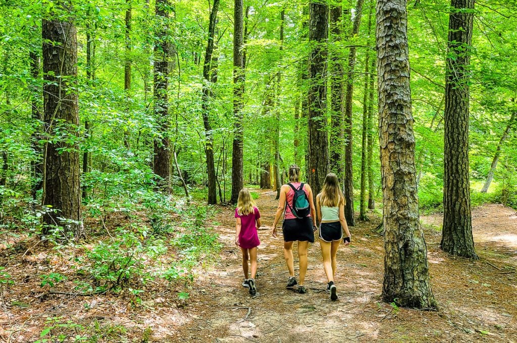
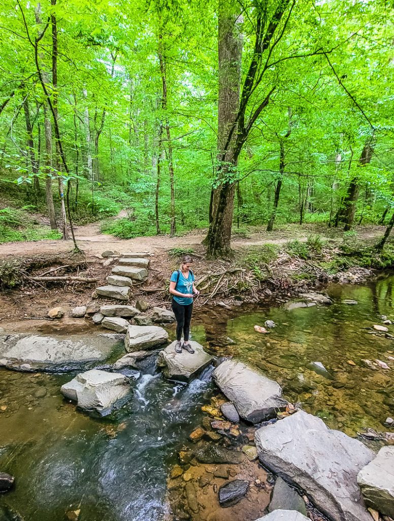
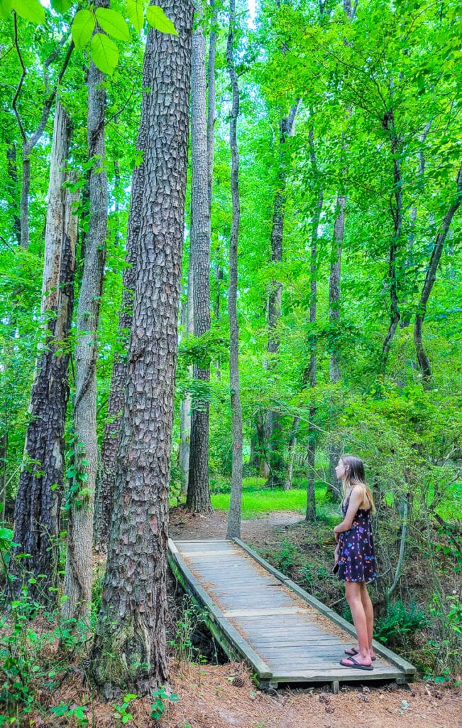
What we love the most about where we live is that there are so many places to go hiking near Raleigh, such as Umstead State Park. Just a 15-minute drive outside downtown and you’ve landed yourself in an area of outstanding natural beauty with more than 20-miles of hiking trails.
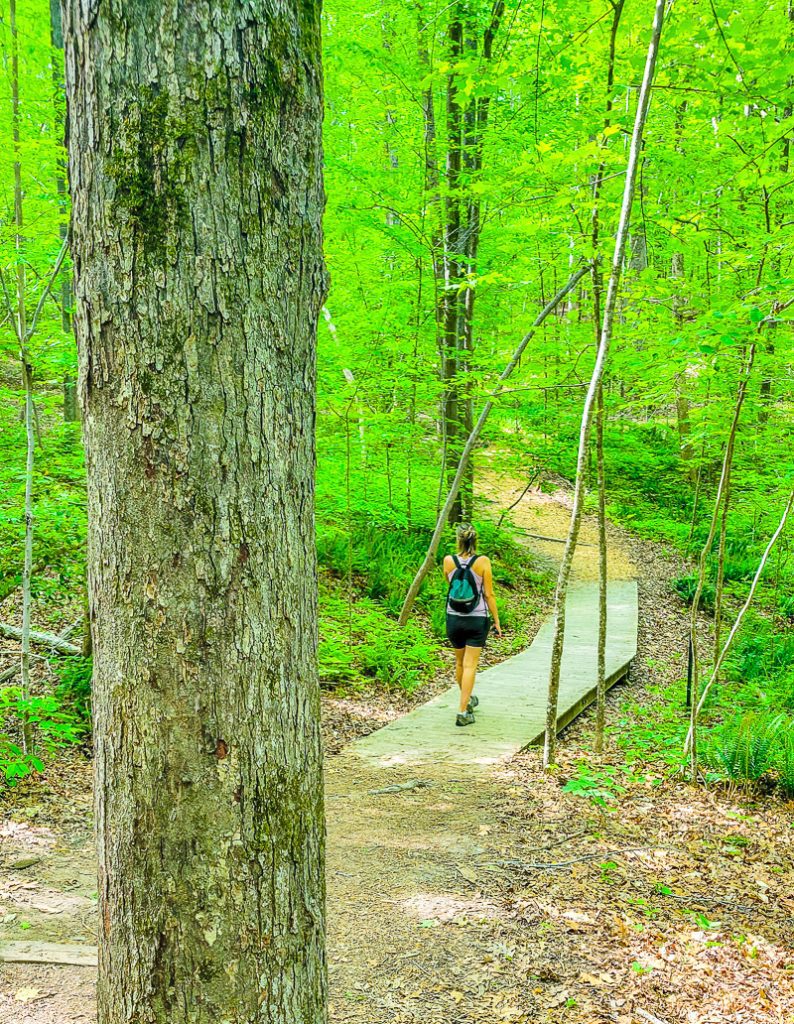
The longest hiking trail in Umstead is the Sycamore Trail, which follows the Sycamore Creek for almost 7.2 miles. The trail is famous for its sycamore trees, which grow in density around the path (hence the name, sycamore trail).
The rich foliage is awash with color and earthy smells, so if you love the sanctuary of the forest, you’ll love the Sycamore trail.
As you wander the trail, you will eventually come to a beautiful arched stone bridge, which offers a strikingly modern contrast from the natural surroundings.
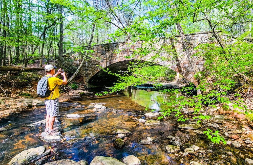
Open year round, this is a great trail to enjoy some peace and serenity (except for maybe the odd plane noise).
It usually takes 2-3 hours to complete the trail and though its inclines are gradual, some areas of the path have exposed roots so be careful with your footing. We recommend you take plenty of water as there is nowhere to fill up your bottle on the trail.
- Length of trail: 7.2 miles
- Trail type: loop
- Elevation gain: 610 ft
- Trail surface: natural surface
- Difficulty level: moderate
- Parking: Sycamore parking lot via entrance off US-70
- Dogs allowed? Yes, but on a leash
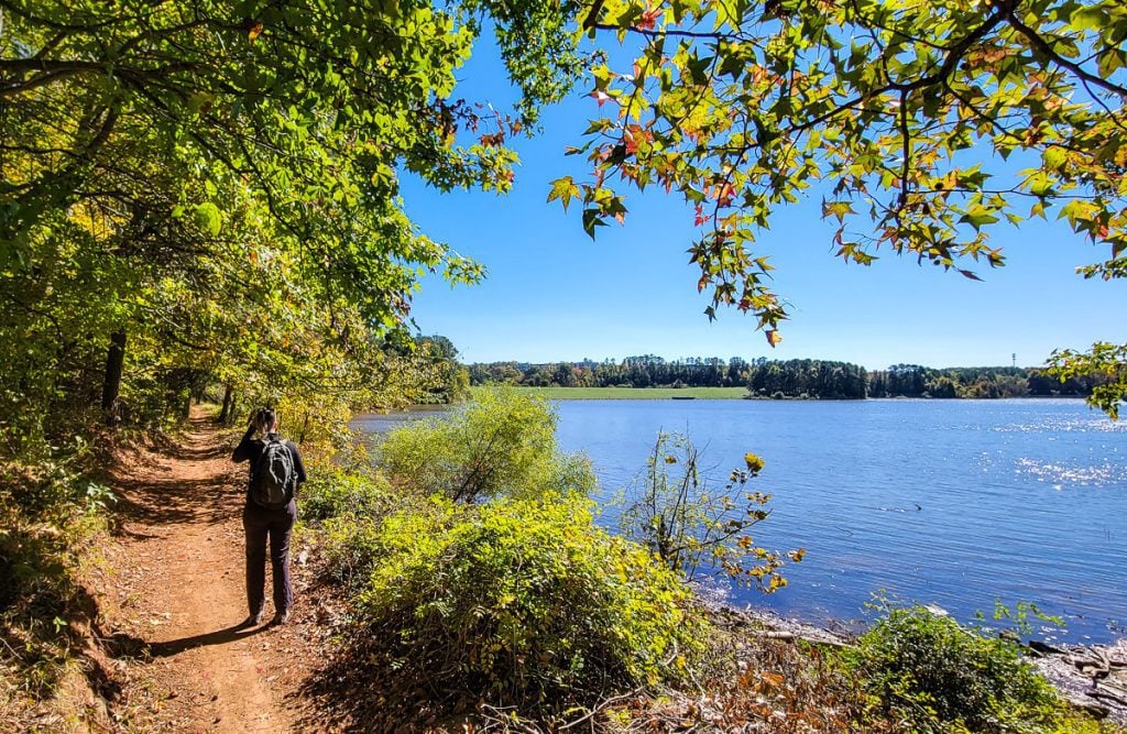
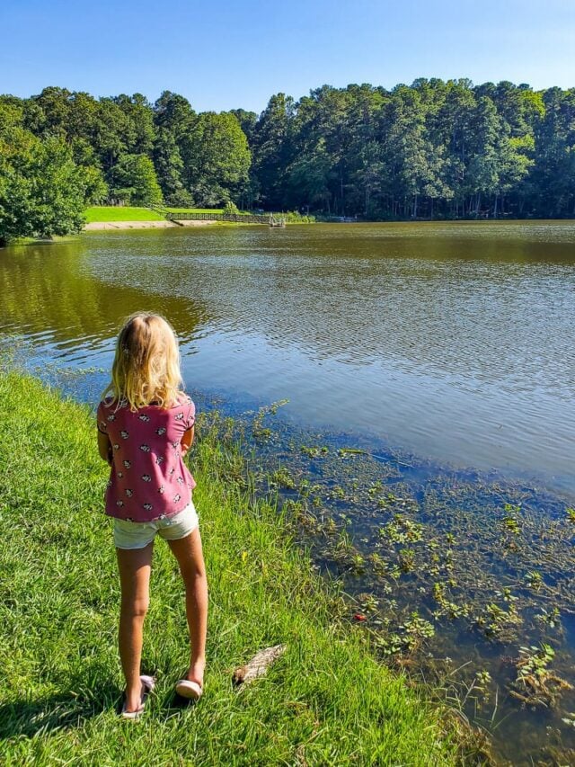
Lake Johnson (best lake trails in Raleigh)
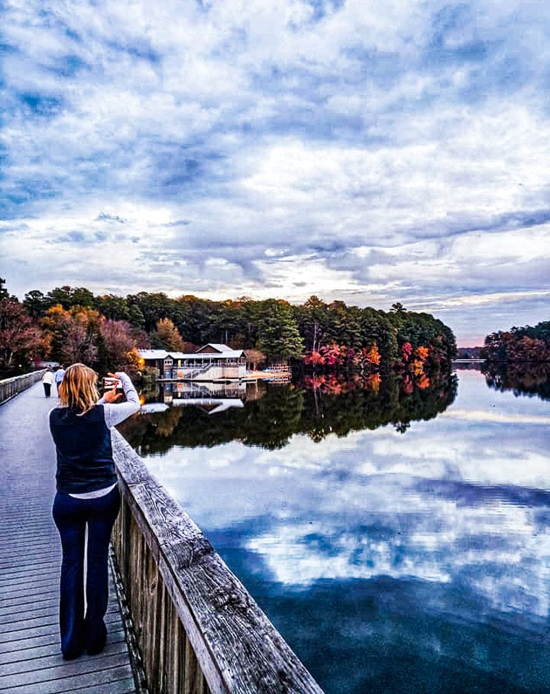
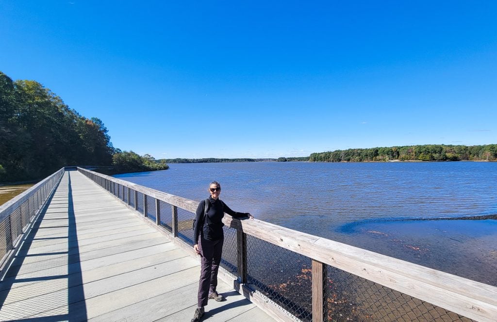
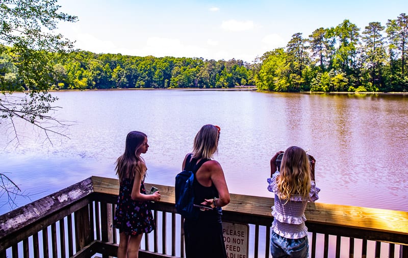
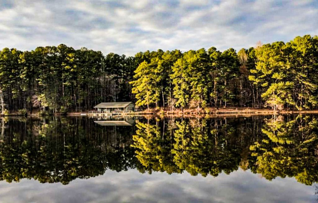
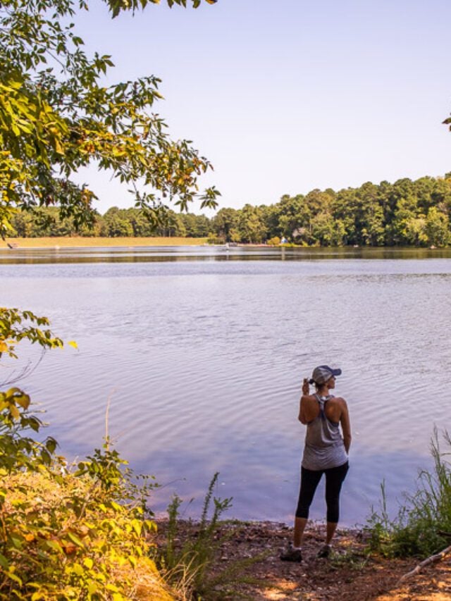
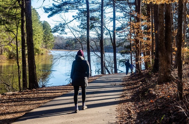
If you’re looking for some Raleigh hiking in breathtaking nature to get some peace and solitude, then the Lake Johnson loop trail is our favorite of the lake trails in Raleigh.
The great thing about this trail is it’s open year-round, and no matter what season you visit, you’re gifted with beautiful natural scenes – from the colorful foliage of fall to the misty hues of winter making the lake shimmer like glass, or the twinkling of fresh green leaves in Spring. It’s no wonder it’s one of the most popular trails in Raleigh.
For those interested in birding and fishing, you’ll find this trail to be your new favorite. The trail begins right by boat shed and lake, offering incredible views from the very beginning.
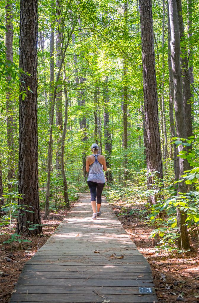
If you don’t have long to spend hiking, the trail can be split into two trails; The East Loop Trail is around 3-miles and hugs the shore of the lake for most of the way offering sweeping views of the lake, while the West Loop Trail is 2-miles and takes you around the lake and into some areas of woodland.

Both loops are considered easy to moderate trails and can be combined to make one 5-mile long hike.
If you opt to do the entire loop trail, it usually takes about 1.5 hours. If you have small children, the East Loop is more practical as it’s paved for strollers the entire way – some steep but short inclines!
- Length of trail: East loop; 3 miles. West loop: 2 miles
- Trail type: Loop
- Elevation gain: 216.5 feet
- Trail surface: East Loop paved; West Loop: natural surface
- Difficulty level: easy to moderate
- Parking: Boathouse off Avent Ferry Road and 1320 Lake Dam Rd
- Dogs allowed? Yes, but on a 6-foot leash.
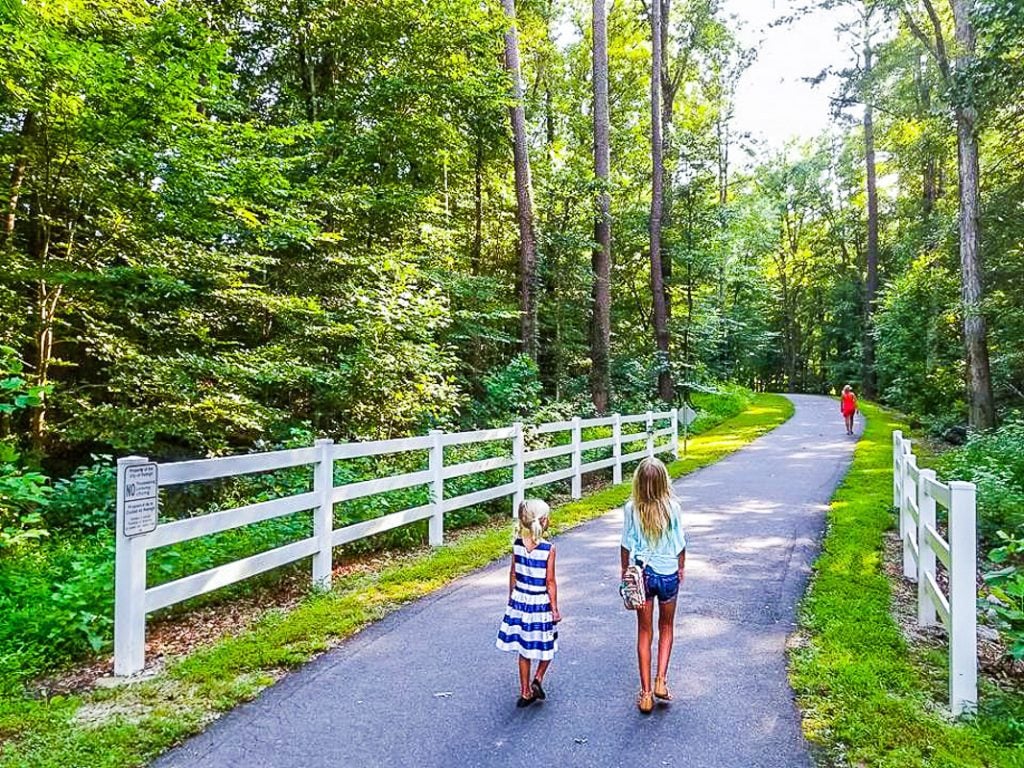
Bike the Art to Heart Trail
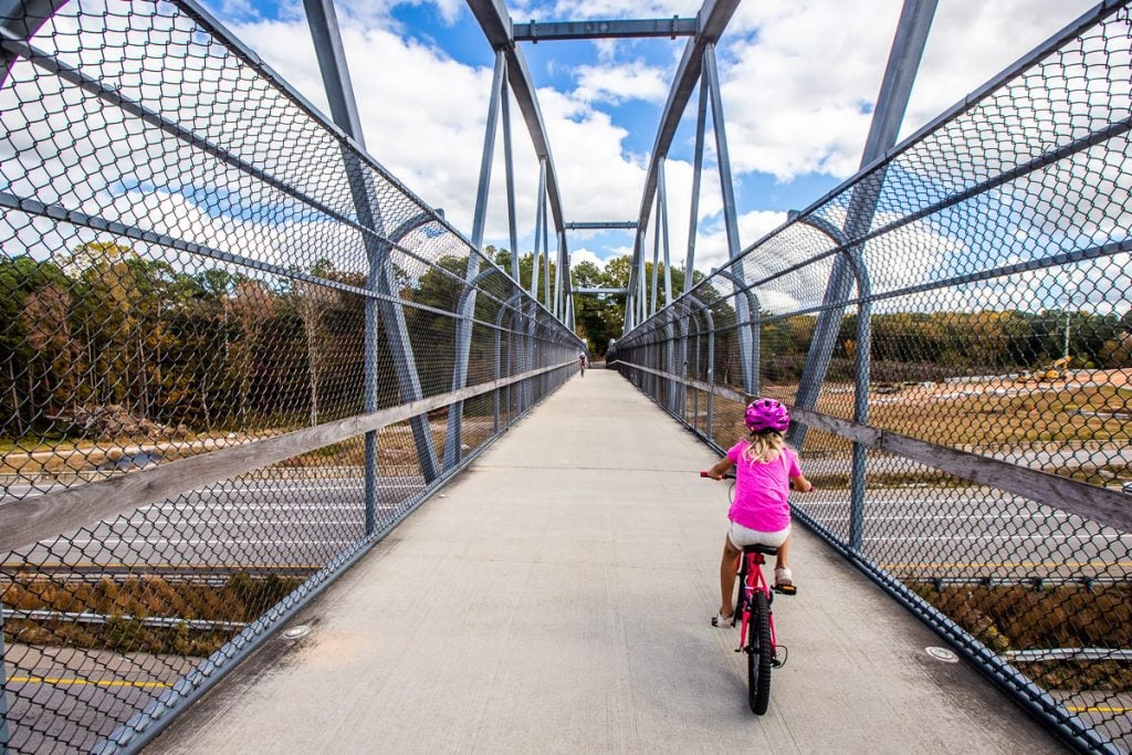
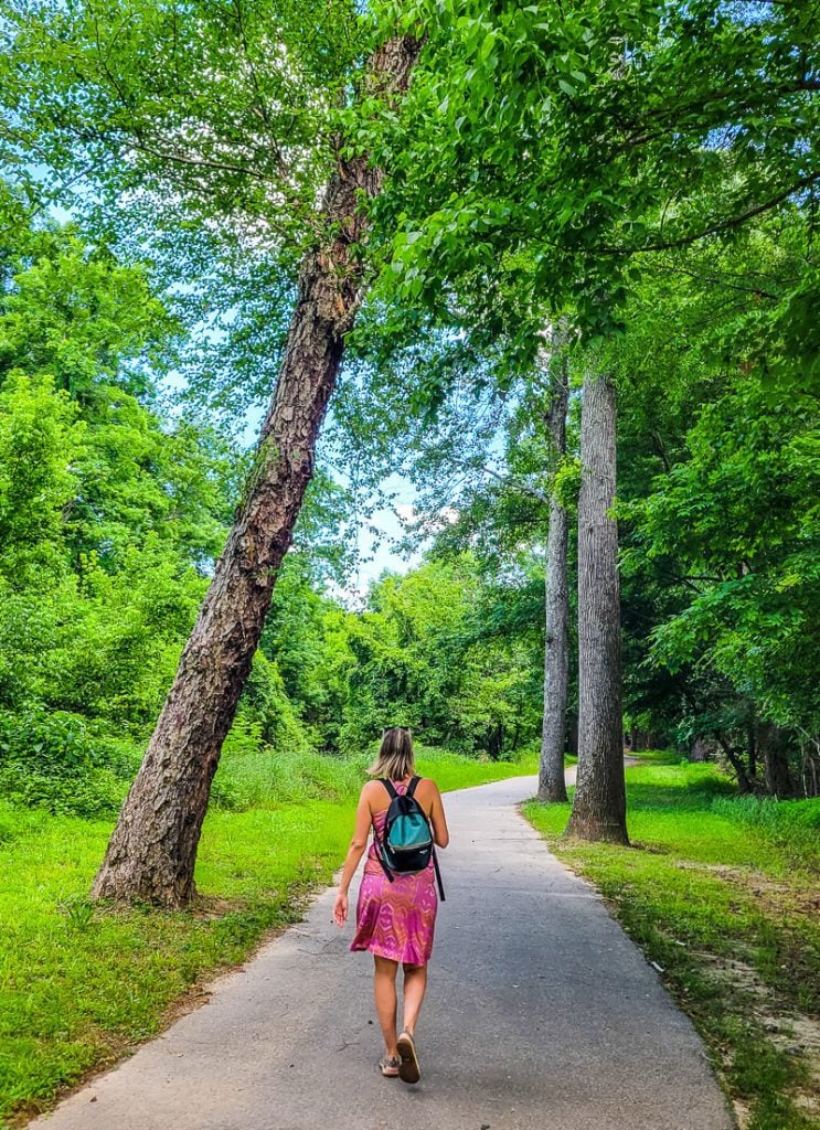
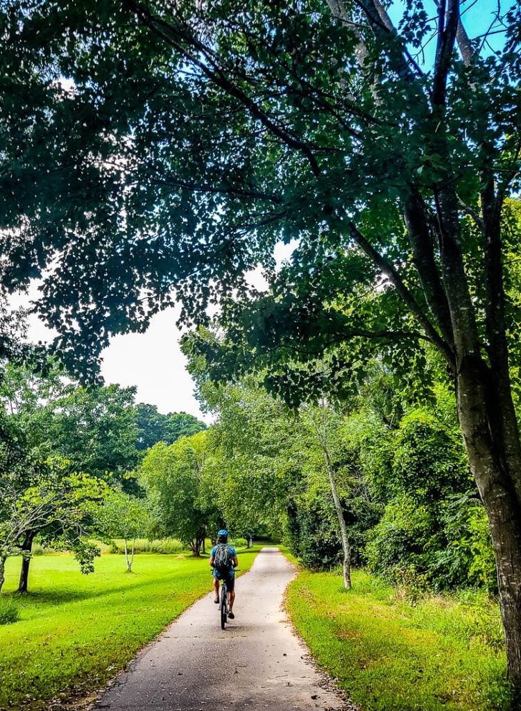
One of our favorite biking trails in Raleigh is the Art to Heart trail, which runs from the North Carolina Museum of Art to downtown Raleigh and finishes at the Duke Energy Center for the Performing Arts.
The biking trail is not only scenic but takes you past some of Raleigh’s top landmarks such as Meredith College, North Carolina State University, and Pullen Park.
This trail is a small section of the iconic East Coast Greenway, which is 3,000 miles long and extends from Maine to Florida.
The first section of the trail takes you through the NCMA’s enormous 164-acre sculpture park, showcasing the state’s premier collection of art. It then leaves the sanctuary of the park and takes you through West Raleigh.
The trail is paved all the way and has a few sections on the road, so be mindful of cars when crossing these sections. The entire trail is lined with lush foliage and greenery, showcasing how beautiful nature in the city actually is. Read our full guide.
- Length of trail: 5.9 miles (each way)
- Trail type: out and back
- Elevation gain: 91.8 feet
- Trail surface: paved, and some areas of road.
- Difficulty level: moderate
- Parking: 1900 Blue Ridge Rd, Raleigh
- Dogs allowed? Not recommended
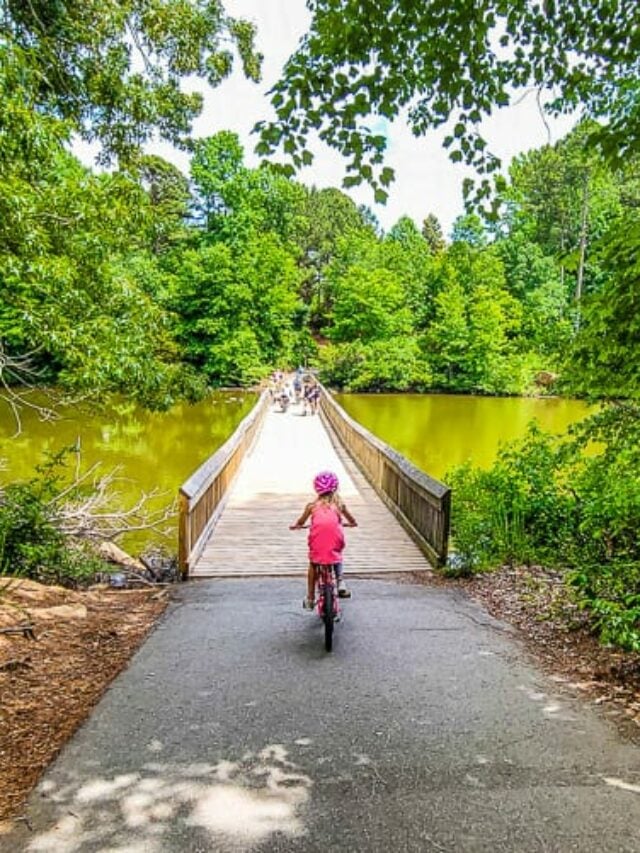
Lake Lynn Loop Trail
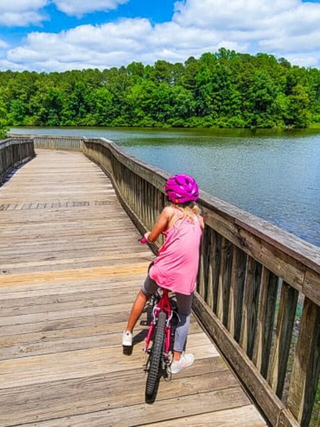
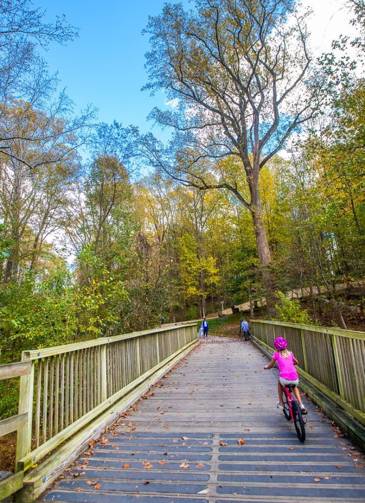
Lake Lynn is a man-made lake in North Raleigh that offers one of the most scenic walking and biking trails and is a tranquil escape from the hustle and bustle of the city.
The lake is a great place to see some wildlife in its natural habitat. Living in the lake are ducks, geese, herons, squirrels, and even some turtles.
Although it’s popular to bike this trail, it’s also used by joggers and walkers, so be mindful of pedestrian traffic when taking on this trail. It’s also popular, so it’s unlikely you’ll have this beautiful trail to yourself, especially on weekends.
The trail is pretty much flat the whole way with some small inclines and is mostly shaded by trees, which makes it a great trail to visit in the summer.
If you’re looking for easy Raleigh trails that your kids can tackle with their bikes they will love this one. Read our guide.
- Length of trail: 4.2 miles
- Trail type: loop
- Elevation gain: 65.6 ft
- Trail surface: paved surface and boardwalk
- Difficulty level: easy
- Parking: Lynn Rd entrance, and Lake Lynn Community Center
- Are dogs allowed? Yes, but on a leash
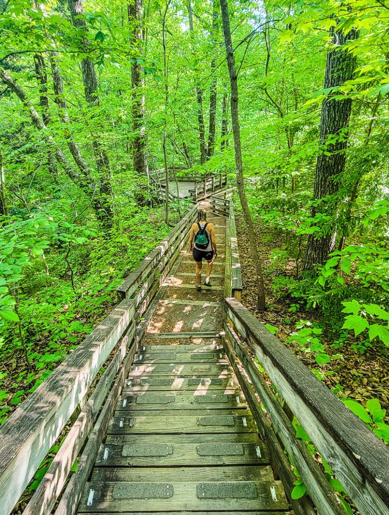
Loblolly Trail, Umstead State Park
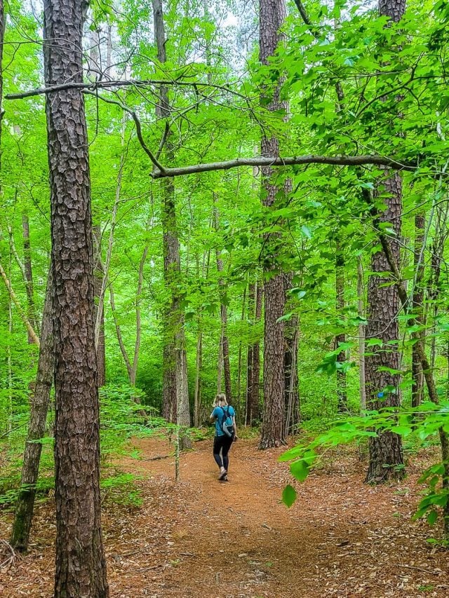
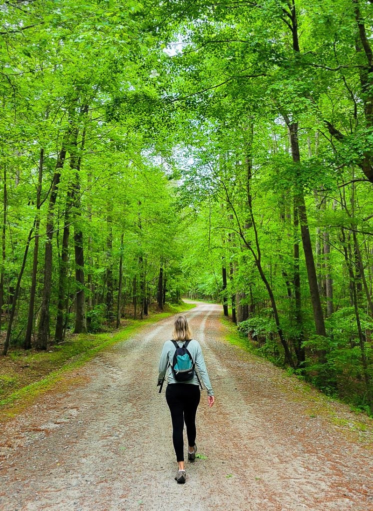
For those looking for hiking near Raleigh that’s a little more challenging, but not mountaineering-level challenging, then the Loblolly Trail in Umstead State Park offers the perfect blend of adventure and outdoor fun.
The trail starts from the northeast corner of the parking lot off I-40 and continues through dense woodland, across a few wooden bridges over streams and rivers, before finishing at Davies Pond.
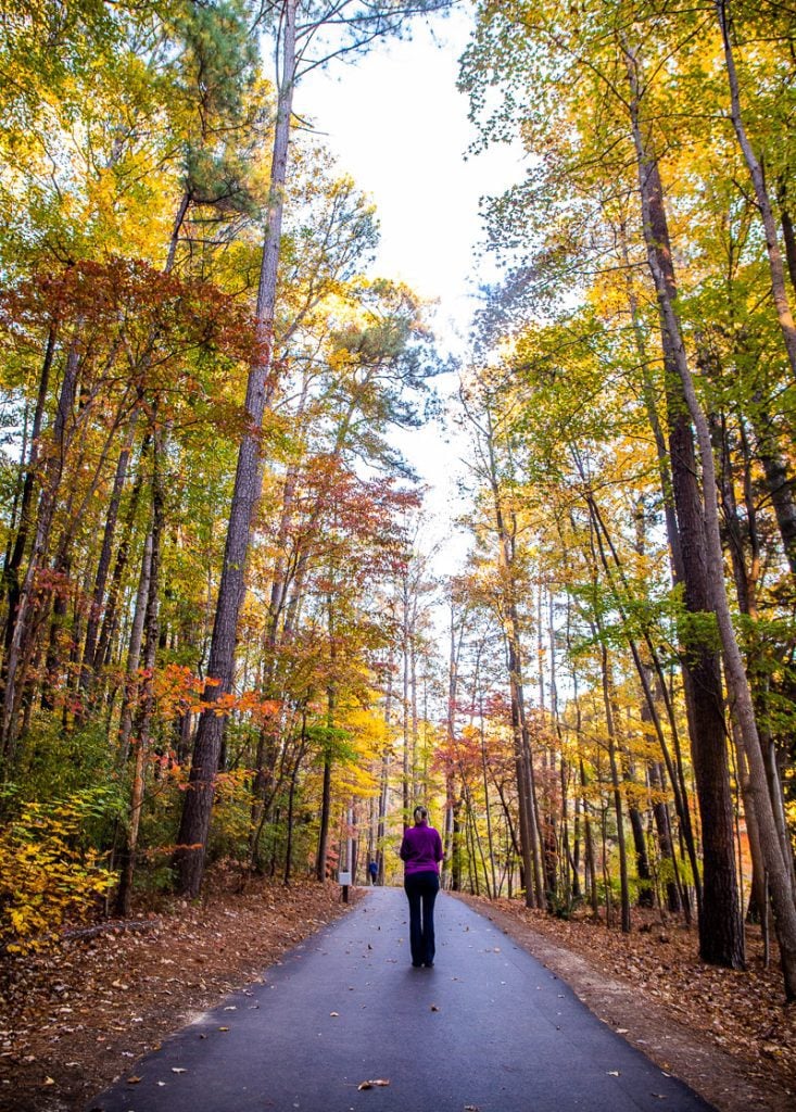
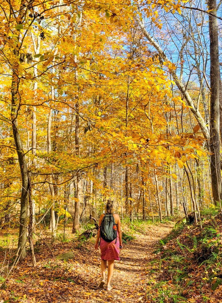
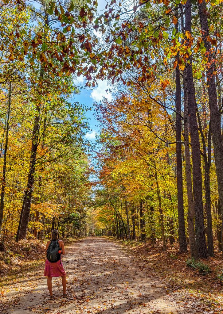
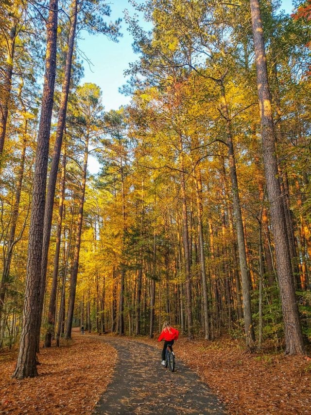
The trail is well marked with signposts, and though it’s open all year round, we don’t recommend visiting after heavy rainfall as it can get quite muddy. The best time to do this trail would be Fall when the leaves are turning to bright shades of red, orange, and yellow. In the summer, it’s well shaded.
When the leaves fall, they cover the ground, illuminating the trail in their vibrant colors. We also recommend getting there early as it’s a popular trail and parking is very busy on weekends
Please note that biking is not permitted on this trail.
- Length of trail: 6.4 miles
- Trail type: out and back
- Elevation gain: 679.1 ft
- Trail surface: natural surface
- Difficulty level: moderate
- Parking: North Harrison Ave entrance off I-40
- Are dogs allowed? Yes, but on a leash
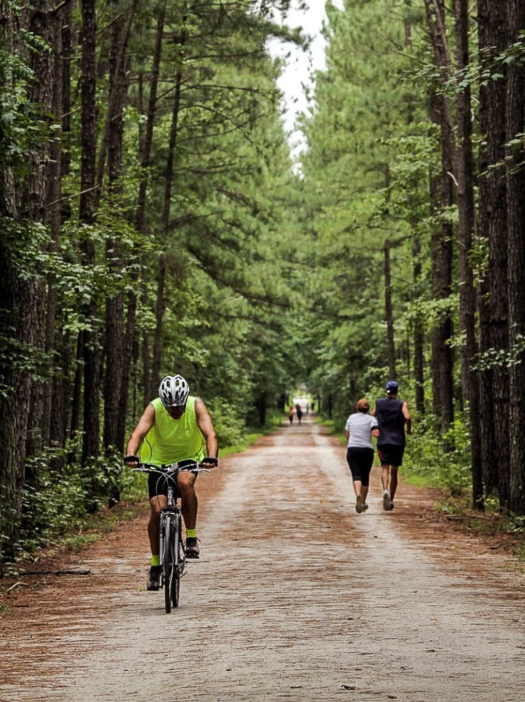
American Tobacco Trail (best long-distance Raleigh trails)
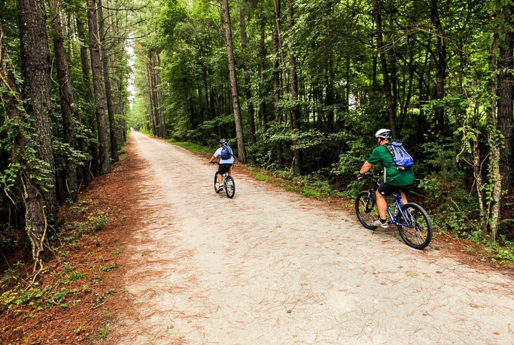
Looking for some seriously challenging Raleigh hiking trails to tackle? Then the 22.1-mile American Tobacco Trail awaits!
This trail takes you through miles of woodland, past ponds and creeks, and into a few urban areas. It also connects to the 75-mile greenway network that extends through the Triangle region so you can imagine this trail will be awash with green trees in the right season.
The trail extends from New Hill Olive Chapel Road to the Durham Freeway in the north. The main trailheads are at Durham Bulls Athletic Park at Morehead Ave, Blackwell St in Durham, and New Hill-Olive Chapel Rd, southwest of Apex.
The trail was the former railroad in the New Hope Valley and later became the Durham and South Carolina Railroad. Eventually, the railroad was moved and the trail was paved for recreation in 2003.
Although long, it’s mostly paved with asphalt or packed gravel, with the occasional wooden bridge and road crossing (more road crossings in the north).
This is a multi-use trail, with hikers, bikers, dog walkers, and horseback riders. Not many people tackle the trail on foot in one day as it will take around 8 hours to complete, but it’s possible to do small sections of it and there are several parking lots along the way.
- Length of trail: 22.1 miles
- Trail type: point to point
- Elevation gain: 682.4 ft
- Trail surface: paved and natural surface with some road crossings
- Difficulty level: moderately strenuous
- Parking: 1309 New Hill Olive Chapel Rd, Apex (in the South), and a parking garage on W Pettigrew St in Durham County near the North trailhead
- Are dogs allowed? Yes, but on a leash
Shelley Lake Loop Trail
For more kid-friendly hiking near Raleigh, don’t miss the Shelley Lake Loop Trail, which takes you on a 2-mile loop around the 52-acre Shelley Lake.
The trail is gorgeous, paved, and is shaded by trees for most of the way, making it perfect to visit all year round. It’s also thriving with wildlife, as some hikers have reported seeing deer, geese, and Bald eagles nesting in the trees.
It’s a short hike that can be completed in less than an hour, but there are some side trails you can explore if you feel like extending your walk, such as the Mine Creek Trail.
The trailhead can be found at the main car park off W Millbrook Rd. When you get to Sertoma Arts Center, you will see a sign with a map that indicates the beginning point. The path then heads down the hill past the kid’s playground on the right toward the lake.
- Length of trail: 2 miles
- Trail type: loop
- Elevation gain: 95 feet
- Trail surface: paved
- Difficulty level: easy
- Parking: The car park entrance is off W Millbrook Road and is easily accessible
- Are dogs allowed? Yes, but on a leash
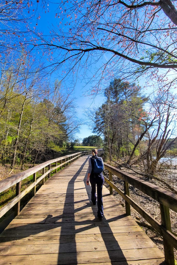
Neuse River Greenway Trail
Another long trail in Raleigh is the Neuse River Greenway which extends for 27.2 miles. The trail is paved and easy for walking and cycling, though it’s mostly enjoyed in sections rather than tackled as a whole – a nice family-friendly section of the trail is from Anderson Point Park.
If you want to start at the beginning, the trails start at Falls Dam and the WRAL Soccer Center in Raleigh.
It then passes through scenic landscapes surrounding the Neuse River, across winding boardwalk areas, and into wetlands, past historical sights and agricultural fields, before finishing at the Wake County border in southeast Raleigh.
The Neuse River Greenway is also part of the greater Mountains-to-Sea Trail, which runs across North Carolina from the Great Smoky Mountains to the Outer Banks.
- Length of trail: 27.2 miles (43.8km)
- Trail type: point to point
- Elevation gain: 564.3 ft
- Trail surface: paved
- Difficulty level: easy to moderate
- Parking: there are several parking lots. See here.
- Are dogs allowed? Yes, but on a leash
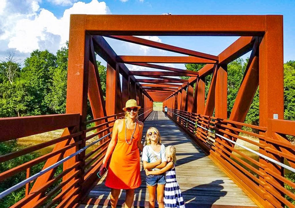
Lake Crabtree Loop Trail
The Lake Crabtree trail is one the most popular biking trails in Raleigh as it seamlessly combines nature and adventure.
The path takes you for around 10-miles through the Lake Crabtree Country Park, through dense forest, before circling the entire perimeter of Lake Crabtree, a 520-acre flood control lake. You can, of course, walk this whole trail or just sections of it like we have.
The trailhead is located at the kiosk next to the Manager’s Office. When on the trail, keep an eye out for the Heather Lee Carr Memorial and Black Creek footbridge, which both offer a scenic viewpoint and rest area.
The park is open all year round but it does close when the weather is wet due to very muddy and slippery surfaces. It’s a good idea to check the Facebook page to see if any announcements have been made before visiting.
- Length of trail: 10.1 miles
- Trail type: loop
- Elevation gain: 475.7 ft
- Trail surface: gravel and natural surface
- Difficulty level: moderately strenuous
- Parking: parking is free from several lots within the park at 1400 Aviation Pkwy and is open from 8.00 am – sunset. Another parking lot is off Old Reedy Creek road.
- Are dogs allowed? Yes, but on a leash
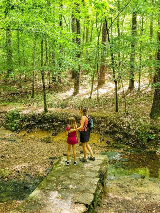
Company Mill Trail, Umstead State Park
The Company Mill Trail is a moderate hiking trail in William B. Umstead State Park. It offers another tranquil escape from the noise of the city and I-40 considering its close proximity to downtown Raleigh.
The hike takes you past Crabtree Creek, which is where the Company Mill site existed in the early 1800s. You can still see the remains of the old dam on both sides of the mill.
After crossing an iron bridge, you will turn onto the looped part of the trail. Turn right onto the trail and follow the creek before hiking up some terraced steps. You then cross over the bike and bridle trail, where you can learn about the destructive impact of the Southern Pine Beetle at the information kiosk.
The trail then extends along Sycamore Creek for a while before looping back around. The last part of the loop can be muddy after a rainy day. Be sure to wear some sturdy hiking shoes for this hike. Read our full guide to this trail.
- Length of trail: 1.9 miles
- Trail type: loop
- Elevation gain: 636 ft
- Trail surface: natural surface
- Difficulty level: moderate
- Parking: North Harrison Avenue entrance off I-40.
- Are dogs allowed? Yes, but on a leash
Sal’s Branch Trail, Umstead State Park
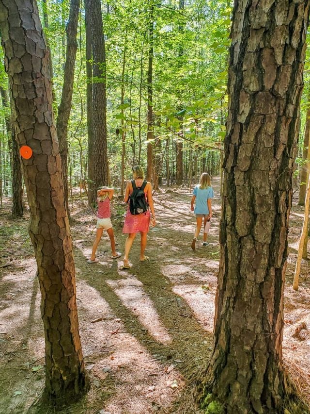
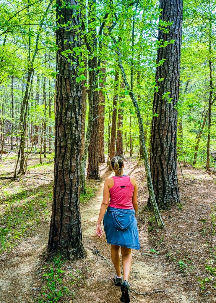
Another one of the best family-friendly hikes near Raleigh in Umstead State Park is Sal’s Branch Trail. It’s probably the most popular of the Umstead park trails.
The trailhead can be found at the northeastern side of Umstead Park, at the Crabtree Creek park access and visitor center off US-70.
The loop trail takes you through woodlands before opening up at Big Lake, which would be a nice spot to unpack a picnic and rest up before continuing the loop back.
Sal’s Trail is suitable for all fitness levels; there are some inclines, but they are usually gradual. It’s a well-marked trail with signposts with orange circles leading the way. Read our guide.
- Length of trail: 2.4 miles
- Trail type: loop
- Elevation gain: 183.7 ft
- Trail surface: natural surface
- Difficulty level: easy
- Parking: Umstead Visitors Center, entrance off US Hwy 70
- Are dogs allowed? Yes, but on a leash
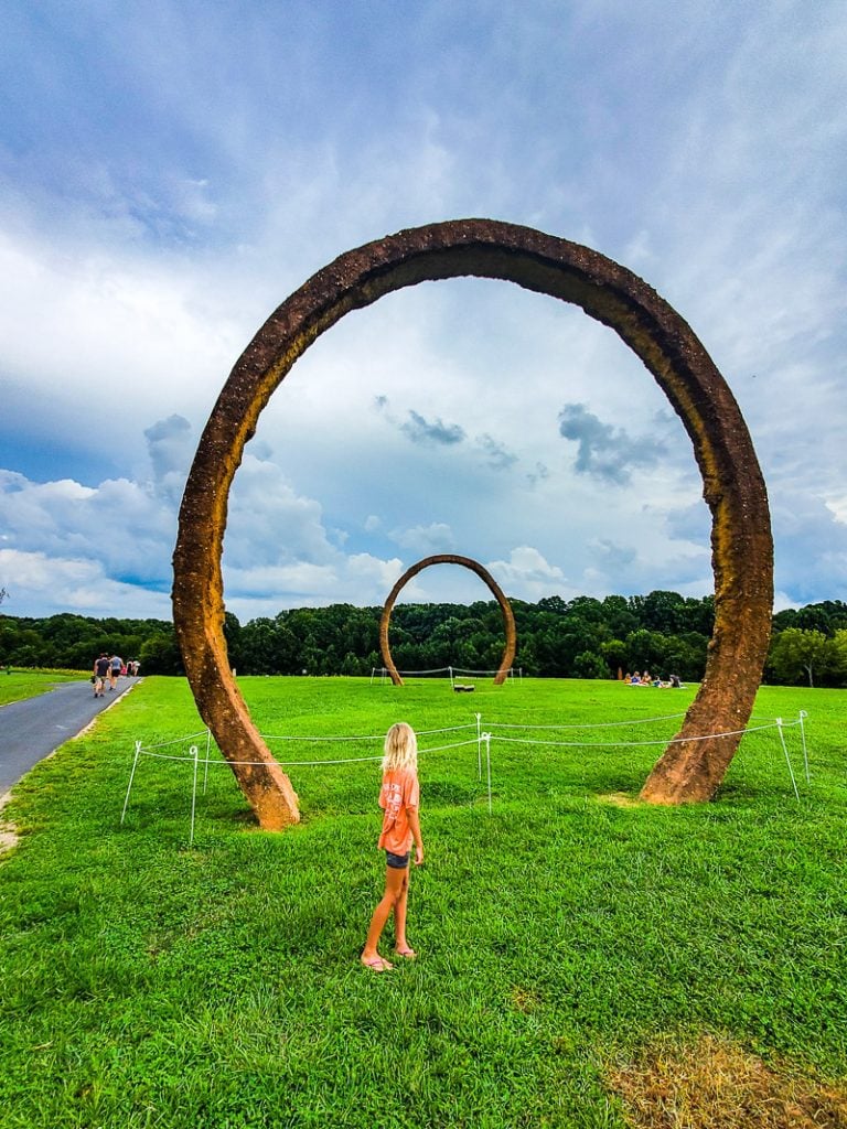
Ann & Jim Goodnight Museum Park Trail
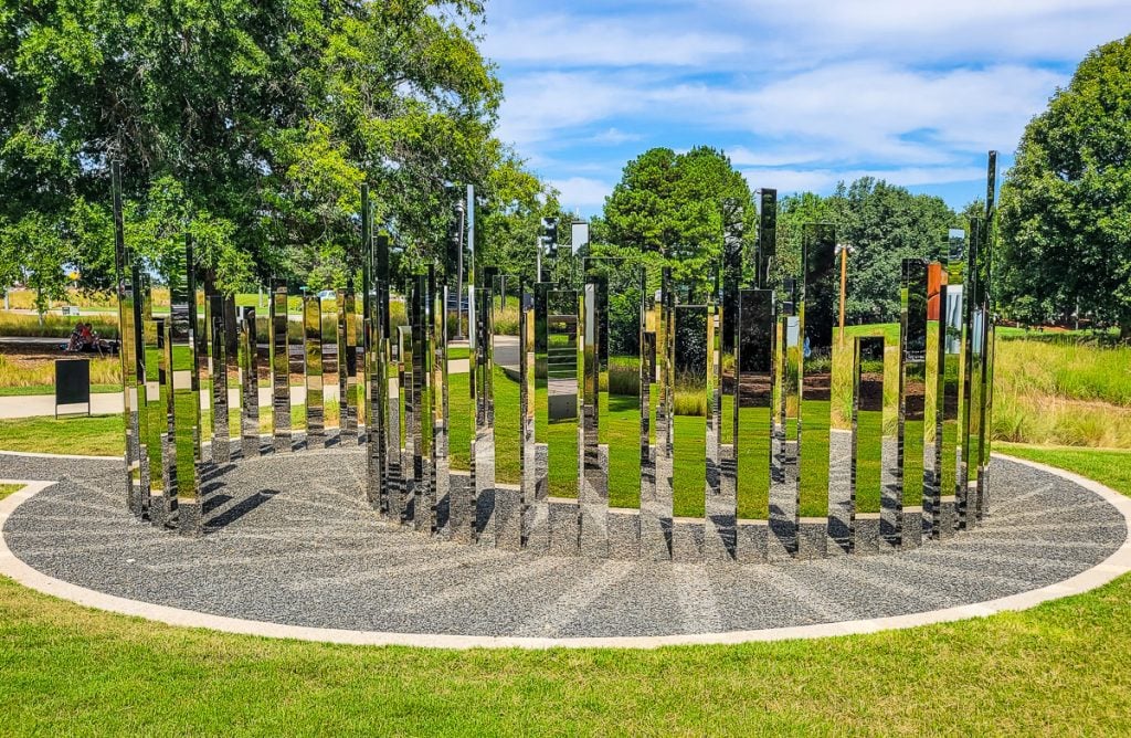
The Ann & Jim Goodnight Museum Park trail is a stunning paved loop around the 164-acre museum park that takes you past art sculptures and nature exhibits.
As well as showcasing art, the trail also has incredible vistas of a pond and a meadow with butterflies. There are a few areas to have a picnic or throw a frisbee around.
In the woodland section, it’s also possible to see native wildlife, such as deer and squirrels, as well as birds nesting in the trees.
This is also a popular trail for bikers, so be careful of cyclists if you decide to walk this trail.
If you want to extend your hike, to the south, it connects to the Reedy Creek Trail which you can hike onto to connect to the House Creek Greenway Trail, and of course the before mentioned Art to Heart Trail.
- Length of trail: 1.6 miles
- Trail type: loop
- Elevation gain: 104 ft
- Trail surface: paved
- Difficulty level: easy
- Parking: 1900 Blue Ridge Rd
- Are dogs allowed? Yes, but on a leash
Yates Mill Pond Trail
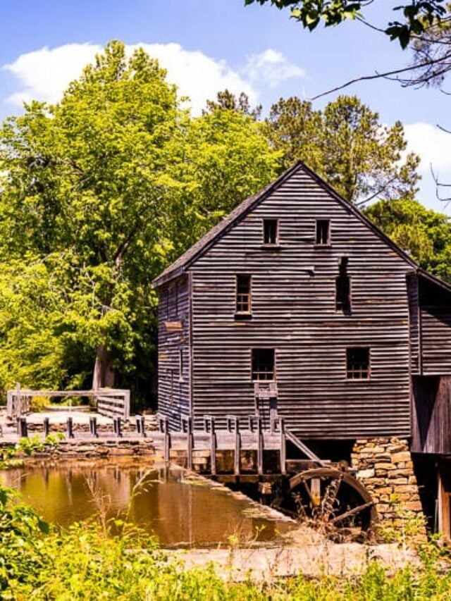
One of the most striking hiking trails in Raleigh for its history is the Yates Mill Pond trail, which is a short and easy 1-mile loop trail that goes clockwise past the historic Yates Mill.
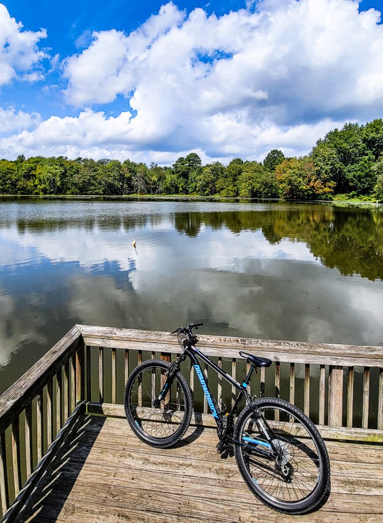
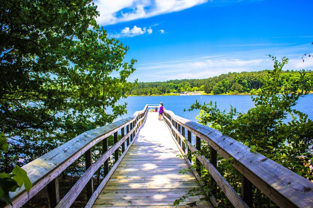
The path takes you past the mill and across the creek towards the lake, where you can fish from the Pond Boardwalk (if you have a fishing permit) or stop at the many viewpoints along the way to look for birds and wildlife.
If this small trail doesn’t seem long enough for you, you can combine it with two other trails in Yates Mill Country Park.
From the wetlands boardwalk, you can continue on to the Creekside Trail which adds another mile or so to your hike. This hike takes you through the Steep Hill Creek floodplain and through some swampy nature. The two trails combined are about 3 miles.
You can also add on the High Ridge Trail which is another 800 meters and takes you across the bridge above the pond.
Make sure you don’t miss the park’s centerpiece, the Historic Yates Mill, which is known as the last operable water-powered gristmill in Wake County. It was added to the National Register of Historic Places in 1974 and was restored to working order in 2005.
The park closes 30 minutes before sunset, so it’s best to go early in the day.
- Length of trail: 0.8 miles
- Trail type: loop
- Elevation gain: 22.9 ft
- Trail surface: boardwalk
- Difficulty level: easy
- Parking: AE Finley Center for Education & Research
- Are dogs allowed? Yes, but on a leash
Crabtree Creek Trail
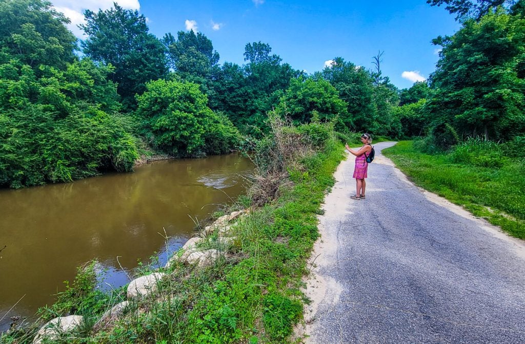
Another long biking trail in Raleigh is the Crabtree Creek trail, which runs through suburban Raleigh for almost 16-miles along the Crabtree Creek corridor, but you can walk a short section as we have done.
It passes through forested greenways, city parks, urban areas, and some industrial areas too. Most known for its diversity of trees, such as loblolly pine, ash, elm, buckeye, river birch, hornbeam holly, and dogwood.
The trail offers nice views of Crabtree Creek, the former site of Lassiter Mill Dam, and the former site of the 18th-century Grist Mill.
The path is mostly paved and has several viewpoints along the way where you can stop and rest and enjoy a picnic. You might also see some wildlife around the wetlands, which is a prime spot for bird watching – lookout for waterfowl and blue herons.
The trail connects to the Mine Creek Trail and Neuse River Trail.
- Length of trail: 15.9 miles
- Trail type: point to point
- Elevation gain: 410 ft
- Trail surface: paved
- Difficulty level: moderately strenuous
- Parking: Anderson Point Park (east end), 4000 Lindsay Dr (west end), 529 Barksdale Dr near DT Raleigh
- Are dogs allowed? Yes, but on a leash
Pott’s Branch Trail, Umstead State Park
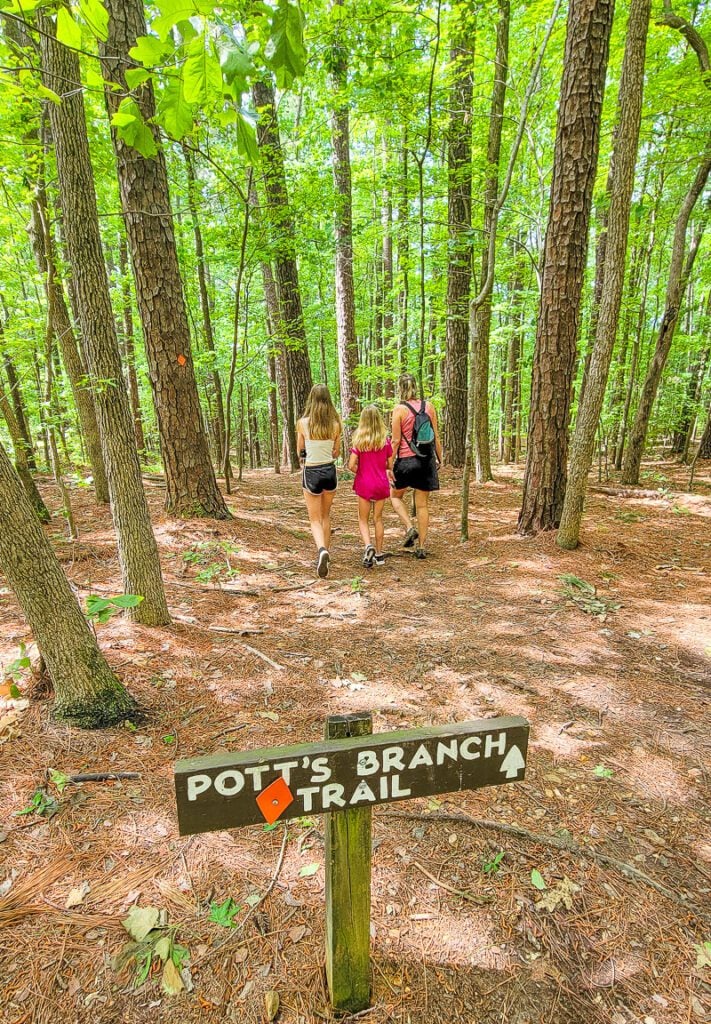
Head back to Umstead Park for one of our favorite easy hikes in Raleigh, the Pott’s Branch Trail which takes you through the iconic dense woodland of Umstead.
This trail follows three small and pretty streams that flow into Crabtree Creek. It’s easily marked by signposts displaying Orange Diamonds.
It’s only 1.3 miles long and can be completed in less than an hour, but if you want to extend this hike you can combine the trail with the shorter Oak Rock Trail, or the longer Sal’s Branch Trail.
- Length of trail: 1.3 miles
- Trail type: loop
- Elevation gain: 610 ft
- Trail surface: natural surface
- Difficulty level: easy
- Parking: Here via entrance to Umstead off Hwy 70
- Are dogs allowed? Yes, but on a leash
Historic Oakwood Cemetery Walk

The Historic Oakwood Cemetery has been the final resting place for 22,000 citizens for over 140 years, including prominent city, state, and national leaders.
The walk through the cemetery is peaceful and there are magnificent oak trees throughout. You can walk your own route or follow the paved route. It’s mostly flat and because the paths are paved it’s accessible for those with strollers.

It’s open from 8.00 am to 6.00 pm, but you’ll have to leave your pooch at home as there are no dogs allowed. While in this area, check out North Person Street, one of our favorite streets in Raleigh.
- Length of trail: 1.6 miles
- Trail type: loop
- Elevation gain: 75.4 ft
- Trail surface: paved
- Difficulty level: easy
- Parking: 701 Oakwood Ave
- than $3 for 2 hours
- Are dogs allowed? No
Hemlock Bluffs Nature Preserve
For those looking for a beautiful nature preserve to stretch your legs, you’ll find there are three small trails in the Hemlock Bluffs Nature Preserve that offer the perfect natural oasis.
This 140-acre preserve is located along Swift Creek and is home to a unique community of eastern hemlock trees and other plant species. The park was created as a joint project between the NC state park system and the Town of Cary.
More than 235 Eastern hemlock trees thrive in this Cary Forest, which is typically only found in Western North Carolina, making it a very unique place to hike in Wake County.
The first trail is the Beech Tree Cove Trail (0.9 Miles) which takes you to an overlook of Swift Creek and connects with the Chestnut Oak Loop Trail (1.2 Miles).
The Chestnut Oak trail takes you through the upland forest with ridges, ravines, and creeks. This trail loops back to the Beech Tree Cove Trail, and from the other side of the overlook, you can head out onto the Swift Creek Loop Trail (0.8 Mile), which offers views of the Hemlock trees, East Bluffs, and Swift Creek.
Hemlock Bluffs Nature Preserve is open from 9.00 am – 6.00pm
- Length of trail: 2.9 miles of trails
- Trail type: loop
- Elevation gain: 65.6 ft
- Trail surface: natural surface
- Difficulty level: easy
- Parking: Stevens Nature Center
- Are dogs allowed? Yes, but on a leash
Walnut Creek Trail
The Walnut Creek Trail is a great biking trail that follows Walnut Creek across southern Raleigh. It’s a 15-mile point-to-point trail and is best enjoyed on a bike, although you can walk it if you want to (just keep an eye out for cyclists).
The trail has a diverse range of landscapes, from natural beauty to urban to residential. Many people who live near this trail use it to commute to downtown Raleigh from urban areas, so even if you’re not looking for it, you may find yourself on this trail at some point.
Most people don’t tackle the whole trail in one day, and it can easily be broken up into sections. The most popular sections are:
- Lake Johnson to NC State’s Centennial Campus
- Centennial Campus to Walnut Creek Wetland Center
- Walnut Creek Wetland Center to Worthdale Park
- Worthdale Park to Neuse River Trail
It is mostly paved with some roadway and connects to the Neuse River Trail to Lake Johnson, as well as the Centennial Bikeway Connector, Rocky Branch Trail, and Little Rock Trail.
- Length of trail: 12.6 miles
- Trail type: point to point
- Elevation gain: 246 ft
- Trail surface: paved and some roadways
- Difficulty level: moderately challenging
- Parking: We started at Lake Johnson boatshed and biked into downtown, or park on the other side of the lake at at 1320 Lake Dam Road
- Are dogs allowed? Yes, but on a leash
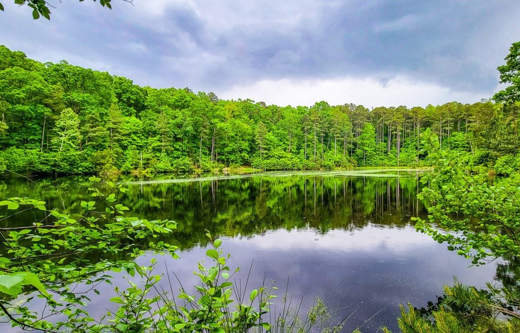
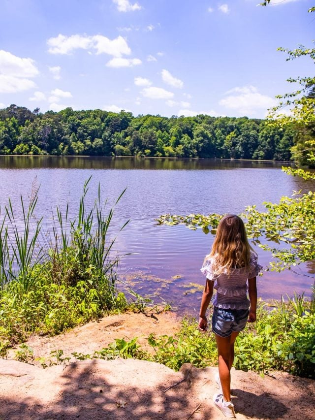
Durant Nature Preserve Border Loop Trail
Another gorgeous lake hike near Raleigh is the Durant Nature Preserve border trail which takes you on a loop around a 12-acre lake and through a wildflower woodland.
This hike is perfect for springtime when the ground is teeming with color from the wildflowers, or in fall when the trees turn a startling red color.
The easy loop trail can be completed in less than an hour and offers lovely scenes of the forest and lake. There are a few rocky areas on the trail, but on the whole, it’s not too challenging.
- Length of trail: 2.4 miles
- Trail type: loop
- Elevation gain: 180 ft
- Trail surface: natural surface
- Difficulty level: easy to moderate
- Parking: 8305 Camp Durant Road
- Are dogs allowed? Yes, but on a leash
New Hope Trail, Jordan Lake (Red and Blue loops)
Another stunning hike around a lake is the New Hope Trail, which has two loop trails around Jordan Lake. The trails, named red loop and blue loop, are both short and moderate to strenuous to hike and combined they create one trail 5.7-miles long.
If you have time for only one, the blue trail is the short but challenging route. It begins near the bathrooms at the boat ramp in New Hope Park and has some areas of steep incline and there are some exposed roots in the natural terrain.
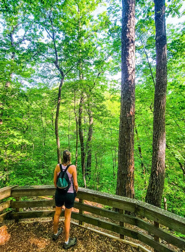
From the top, hikers can enjoy stunning views of the lake, hardwood forests, and groves of Mount Laurel from the viewpoint.
The route then takes you through lush creek crossings and passes a variety of wildflowers and ferns before connecting back to the start, where you can enter the red loop.
The red loop has much of the same landscape as the blue loop but offers a different perspective of the lake. This hike is well-marked but there could be some fallen trees on the trail that require climbing over.
- Length of trail: 5.7 miles (red & blue loop combined) or 2.6 miles for the blue loop
- Trail type: loop
- Elevation gain: 606 ft
- Trail surface: natural surface
- Difficulty level: moderately challenging
- Parking: near the ticket booth on New Hill
- Are dogs allowed? Yes, but on a leash
Bond Lake Loop Trail
If you’re looking for more lake trails near Raleigh, then the Bond Lake Loop Trail is a great option for all levels of fitness.
Bond Lake is a man-made freshwater lake in the Fred G. Bond Metropolitan Park, the largest municipal park not far from downtown Cary and one of the largest in Wake County.
The trail hugs the 42-acre lake and is a mix of paved and natural surface terrain. It’s possible to bike the whole trail, but the unpaved section is a little challenging with exposed roots and a few inclines to be aware of.
This trail is mostly shady with a few exposed areas where you can bask in the sun. It takes less than an hour to walk the entire lake, but there are five other trails you can do to extend your walk including the Paw Paw Trail, Pinecone Trail, Black Creek Trail, White Oak, and Oxford Hunt Greenways.
Check out the Bond Park map to plan your route. This trail is open from 7:30 am until sunset, so be sure to visit early in the day to enjoy this space.
- Length of trail: 1.6 miles (2.7km)
- Trail type: loop
- Elevation gain: 52.4 ft
- Trail surface: paved and natural surface
- Difficulty level: easy
- Parking: available at the Bond Park Boathouse
- Are dogs allowed? Yes, but on a leash
Lake Pine Trail (Apex Lake Loop)
The Lake Pine Trail is another kid-friendly hiking trail near Raleigh that takes you around the pretty Lake Pine not far from downtown Apex for around 2 miles.
The lake is a popular spot for fishing (with a permit), canoeing, kayaking, paddle boarding, and boating.
The trail hugs the shore of the lake and is paved asphalt and concrete the entire way, making it accessible for strollers – though there are some elevated sections that have been signposted, but not too steep for a stroller or wheelchair user.
Lake Pine trail passes through some woodland that is shaded by trees, which can be a bit muddie during wet months, but not enough to be impassable.
This trail is open all year round, from 6:30 am until 10:00 pm from March – October, and until 7.00 pm from November – February.
- Length of trail: 2 miles
- Trail type: loop
- Elevation gain: 59 ft
- Trail surface: paved
- Difficulty level: easy
- Parking: there is parking off Lake Pine Drive and Laura Duncan Rd
- Are dogs allowed? Yes, but on a leash
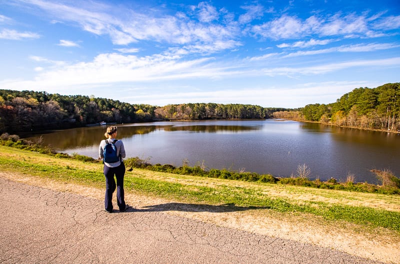
Falls Lake Trail
Falls Lake is a huge 50.22 km² lake that is surrounded by the Falls Lake State Recreation Area. There are many places to go hiking around the lake, but one of the popular hikes is the Falls Lake Trail, which follows along a section at the southeastern basin of the lake.
This trail is a nice little walk that’s mostly covered by trees with some viewpoints of the lake through the trees and connects to the Possum Track which is usually the point where hikers turn around and come back.
The trail is open year-round but it can be muddy after the wet season and hikers should wear sturdy shoes as there are some exposed roots and uneven terrain throughout.
- Length of trail: 5.2 miles
- Trail type: out and back
- Elevation gain: 413 ft
- Trail surface: natural surface
- Difficulty level: moderate
- Parking: Raven Ridge Road
- Are dogs allowed? Yes, but on a leash
Falls Lake Loop Trail to Falls Dam
The last of the Raleigh trails on this list takes you to one of the most impressive structures in Raleigh, Falls Dam. The hike begins at Annie Wilkerson’s main parking lot and starts on the Epps Forest loop trail.
Once you reach the boundary of the Preserve, turn right and follow the MST trail the rest of the way. It takes you to the Visitor’s Centre at Falls Lake Dam itself, as well as across bridges, through dense woodland, and back around to the parking lot.
The dam is the highlight of this trail, which seems to effortlessly blend into the natural landscape around it. Photographers will relish in the mirror reflections created on the calm, undisturbed waters of the lake – if you’re looking for calmness, this is a good spot to find it.
This trail is open all year round but be careful when visiting after rainfall as it can get muddy in places.
- Length of trail: 6.2 miles
- Trail type: loop
- Elevation gain: 469 ft
- Trail surface: natural surface
- Difficulty level: moderately challenging
- Parking: Annie Wilkerson’s trailhead
- Are dogs allowed? Yes, but on a leash
Best Raleigh Trails Podcast Episode
For those who may prefer watching a video of us podcasting, we filmed that for you too, which you’ll find on YouTube each week.
There you have it, some of the best Raleigh trails to explore. Leave us a comment below with your suggestion on any Raleigh trails we should add to this list?