

For a capital city, Raleigh’s public transportation systems are working to get better. There’s not a lot about life in Raleigh we don’t like, but a lack of public transit by way of a tram or train is our biggest pet peeve. I wish we could tell you all about how to get around Raleigh effortlessly like that, but we can only help you with what we’ve got.
Raleigh is predominantly a driving city, so infrastructure supports that the most. It’s not all bad; Raleigh does have some urban transportation options to choose from. While you won’t find a metro system here like in big cities such as New York City or Chicago, that doesn’t mean getting around Raleigh is difficult.

If you don’t drive, it’s very easy to get from A to B by either bus, ride share apps like UBER or Lyft, bike or e-bike/e-scooter, or walk (our preferred method to get around in downtown Raleigh). If you’re not sure how to navigate Raleigh’s public transit system or want to know what the roads are like to drive on, this guide has everything you need to know about how to get around in Raleigh.
Getting around Raleigh by car
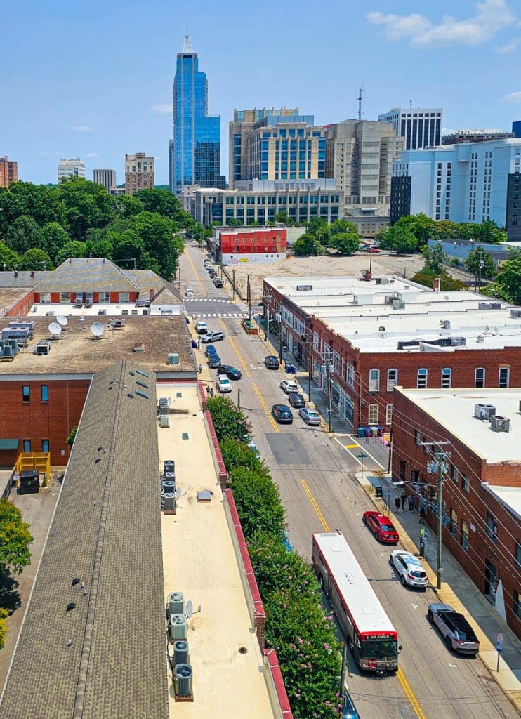
As mentioned, Raleigh is a driving city, and this is the most preferred way to get around. As for traffic, compared to other cities that have horrible traffic, like Atlanta or Los Angeles, Raleigh’s traffic isn’t too bad, depending on what you’re used to. That being said, the area is growing, and more and more people are moving here, which means more cars on the road. It certainly won’t stay an easy driving city for long!
Peak hour is the most congested time, especially on Interstate 440 (I-440), which loops around downtown, and the I-40 corridor between Raleigh and Durham (and the Research Triangle Park).
Interstate 440 (I-440) is also known as the I-440 beltline, Raleigh Beltline, the Cliff Benson Beltline, or simply The Beltline. It travels in both directions, clockwise and anti-clockwise (or east/west), and encircles downtown Raleigh with numerous exits to all parts of the city.
Driving in Raleigh is just as safe as any other city, but you should watch out for a few notable roads that often have pile-ups and car wrecks. The particular parts of the I-440 that sees the most accidents are between Glenwood Avenue and Six Forks Road and between Capital Boulevard and Wake Forest Road.
The section of the I-40 between Rock Quarry Road and Hammond Road also often sees accidents.
That being said, Wallet Hub listed Raleigh as its #1 worst place to drive in the USA in 2023, which, to be honest, is a bit surprising! I mean, Raleigh isn’t terrible, but I wouldn’t place it in my number one spot. Thankfully, Raleigh moved down to the 11th spot in 2026, so it shows that the city is improving.
If you need a rental car, your best bet is to grab one from Raleigh-Durham Airport (RDU) if you’re flying in, or there are a few companies within the downtown area.
Getting around with Ride-Share Apps
Of course, Uber and Lyft have a good presence in Raleigh, so you’ll be fine to use these apps if you don’t have a car or know how to drive.
If you are visiting Raleigh for a concert, sporting match, conference, or any other event for one night, you might want to have a look at Share the Ride NC, which is a car pool website where you can find people going to the same destination as you, and share the ride. It’s a great way to save money and emissions. You can check the STRNC service here.
Parking in Downtown Raleigh

Parking facilities for downtown Raleigh include street parking, parking lots, and parking decks. See the parking map here. With the continued growth of downtown with more and more cafes, restaurants, food halls, breweries, bars, boutique shops, and numerous other things to do, it’s getting harder and harder to find parking, depending on the day of the week and time of day!
Street parking is signposted. If you see a blue sign, you have to pay between 8am to 5pm, Monday – Friday. On the weekends and after 6pm, street parking is free.
Green signs have limited time e.g. “1 hour parking” or “2 hour parking” but can also say “permit required” – read the times carefully.
Pay attention to signs and what they mean. Keep in mind that numbered parking spots typically mean a payment is required in the designated time period. The easiest way to pay is via the Passport parking app. Look for the sign near your parking space and enter the code into the app. You will then pay via the app for the amount of time you want. It will notify you when your time is nearly up so you don’t forget! If there are limits to how long you can park, you can extend your time via the app if needed without returning to your car.
For parking decks and parking lots, check out this interactive parking map by the Downtown Raleigh Alliance. You can also take advantage of the park-and-ride bus system, which takes away the pain of trying to find parking in downtown. Simply park at one of the parking lots out of town, and get the bus network in. See park and ride locations here.
The city parking decks in Downtown Raleigh are currently free for the first two hours! This is a fantastic initiative to help those reduce their costs and choose to spend more time downtown Most neighborhoods will have free parking. North Hills has just introduced limited – yet still free – parking. Be sure to register when you park by scanning the QR code. You get three hours for free. It is strictly monitored and you will end up with a fine if you go over – speaking from experience.
Getting around Raleigh by bus

Raleigh has an extensive network of local routes. The GoRaleigh bus service is pretty good. It connects most of the Raleigh area. For other parts of Wake County, you can catch the GoCary (formerly C-Tran) or GoApex buses. If you want to get to the Research Triangle Region, you need to catch the GoTriangle bus service network.
The Wolfline bus service is the NC State University’s bus service and not only serves the students but also the general public fare-free (no student ID required). This service connects all three campuses, official NC State housing, some private apartment complexes and three park-and-ride lots.
The buses are red, white, and black with the Wolfline logo lettering. Wolfline bus systems operate every day classes are in session. See the bus schedule here. Some of the Wolfline stops are the same as the RaleighGo buses, so make sure you get Wolfline buses where possible and save on the fare!

Then there are the R-Line and Commuter Express Routes. The R-Line is Downtown Raleigh’s bus route, also known as the downtown circulator, and connects professionals working in downtown to the Central Business District.
Getting around by bus is convenient and easy, and bus fares are pretty cheap. Plus, the buses are clean, well-maintained, and many buses have WiFi. We catch the bus regularly and love it for its convenience and ease and for saving money on parking and ubers. You can read our guide on how to ride the bus in Raleigh (with some fun bus excursions we did)
They have also begun construction on North Carolina’s first bus rapid transit (BRT) line, which connects New Bern Avenue in downtown Raleigh to New Hope Road. This will have dedicated lanes for buses, meaning you can avoid the peak-time traffic on interstate highways. Work has already begun, and it’s expected to be completed by 2035.
Bike Raleigh (or Bike Share)
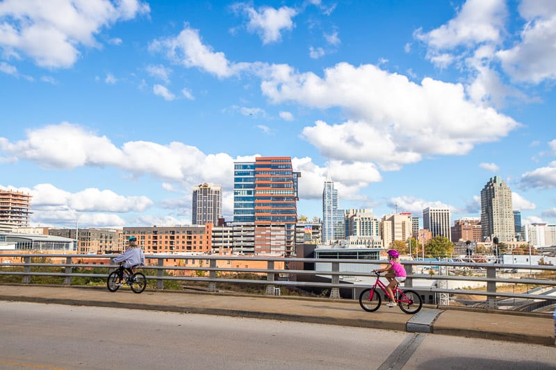
A great way to get around Raleigh, especially in the summer, is by bike. Raleigh is a bike-friendly city, and new bike lanes are popping up all the time. Do be very careful, though, as far too many cyclists get hit on the roads. Raleigh has miles of greenway trails to ride on as well. If you can take one of those and avoid the busy roads, it will be a far more pleasant experience.
You can, of course, ride your own, or you can rent a bike with Spin or Lime, the local bike-share systems being piloted in Raleigh. These bike-sharing apps are available to the public, and are a self-serve bicycle rental system for short trips, allowing you to get around downtown Raleigh easily.
Spin and Lime also have e-scooters, and operate as a “dockless bikeshare system,” meaning you can leave your bike or scooter in designated parking bays, or in accordance with parking laws, rather than cycling around trying to find a drop-off point.
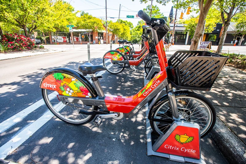
To ride, you will need to download the apps and input your bank details. If you plan to cycle a lot, you can pay for daily bike hire or 30-minute sessions, rather than pay as you go, which works out cheaper.
Pay-as-you-go (pay per ride) prices for e-bikes are $2 for the first 10 minutes, then $0.20 per minute for Lime, $0.015 for Spin. For scooters, it costs $1 to unlock + $0.41 per minute
BikeRaleigh has maps showing bike lanes, sharrows, greenways, and GoRaleigh routes, as well as preferred routes that are based on bicyclist feedback and street conditions. Check out the following videos sharing some of our favorite bike trails in Raleigh! And if you like biking you may love this ebike tour on the Neuse River Greenway.
Stay Connected to Raleigh
Join our free email community to receive free checklists, guides, insider tips, personal stories, fun finds, and the best events in Raleigh each week. We'll show you how to stay connected to Raleigh and love where you live! Join Below 👇
“Your weekly newsletter is a lifesaver for me. Yesterday we didn’t know what to do, I just check your list of events for the weekend, and we ended up in Cary at the Carolina Circus Festival. We had a great time so thanks a lot for all your good work 😊 we really appreciate you” Subscriber
